Pleasant walk along the Roubreau valley.
Embark on a walk along the picturesque Roubreau valley, following in the footsteps of the Sarpes-Bruges. But did you know that this evocative name hides a fascinating past? Indeed, Sarpes Bruges takes its name from a rich local history: The term "sarpe," meaning "to cut," and "Bruges" reminds us of the heather that grew abundantly in the region. In the past, this heather was precious, used to make hoops where silkworms would attach themselves.
See more
Home supplement
Medium
Sort
- BOUCLE
Opening
All year round daily.
Route
Prices
Free access
Free access.
Activities
- Pedestrian sports
- Hiking itinerary
Access
Environment
Departure : Parking des terrains de jeux, Tauriers. Arrival : Parking des terrains de jeux, Tauriers. Road access : Coming from Largentière, follow the signs for "Tauriers," passing in front of the hotel management school. The parking is located at the last hairpin bend before the village..
Tips
Departure from the playground parking lot: Follow the left path towards the village. [Largentière 4.1 km]
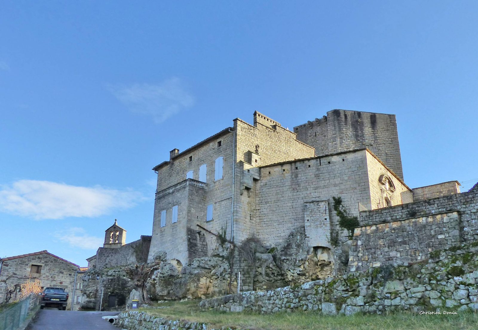
Place des Sarpes-Bruges: [Largentière 1.4 km] Pass under the archway and behind the castle. Turn onto the path that goes down through the woods to the left of the cemetery, follow the road 100 m to the right, then take the drivable path on the left. Continue on the cobbled path which offers a view of Chassiers, Largentière, and its church. Cross the road and take the cobbled path alongside the house; descend towards the town center by taking the Marronniers ascent, then the Docteur Tourvieille ascent.
Turn right until you reach the church.
At the church, follow: [Tauriers 4 km] Go around the church and then climb the cobbled path on the left. Upon reaching the road, turn right, descend for 70 m, then take the cobbled path on the left. Reach the Soleil bridge. Take the cobbled path to the right of the bridge and continue straight on the road for 2 km.
Les Vers: At the crossroads, you can shorten the route by turning right towards: [Tauriers 1.7 km] You will arrive directly at step 6. Otherwise, continue towards: [Le Plançon 2.7 km, Joannas 5.9 km]
Berty: [Tauriers 3.5 km] The path climbs through the woods and reaches the road. Turn right and follow the road to the village of Tauriers, which you cross to reach the parking lot.